


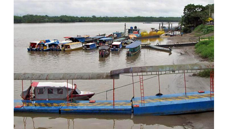
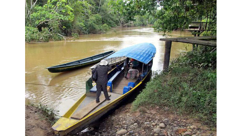
Once on the water, we could see the rainforest pushing close to the river. The town of Coca, a depot on Ecuador’s Rio Napo, was already slipping away, disappearing behind a bend. It was early morning. There had been a week of heavy rain and trees had fallen into the river as the bank washed away. With the pressure of the current, branches emerged from the brown water and waved up and down, as if saying goodbye. Older branches, now blackened and leafless, broke the surface and then silently disappeared.
After an hour, we began to see wildlife: toucans and parrots, movements in the trees that suggested monkeys. On one log, I spotted four turtles sitting in a row, each with a butterfly on its head. (I took this as a sign, an offering; it turned out to be the standard post-card image from the Napo valley.) I had been on the lookout for caiman, fresh water alligators, which entertained our guides — sharp-nosed men who grew up along this river. The men were from one of the local tribes, most likely Huaorani, Kichwa, or Shuar. They wore t-shirts and baseball caps.
There were three of us: Tim, a biologist; me, an English professor; and Carly, a student from our summer program in Ecuador. We were at the far eastern edge of the settlements below the foothills of the Andes, and we were at the far western edge of the rainforests of the Amazon basin. Between here and Manaus, the first “real” city to the east, 1200 miles away, far into Brazil, a brave traveler would find few roads and little else other than indigenous villages, some seldom visited by the 21st century. Tim, Carly, and I were headed two hours downstream, deep into the Ecuadorean rainforest, speeding toward the headwaters of the Amazon in long, thin metal canoes, each with two 175-horsepower Yamaha outboards on the back — one to navigate downstream, two to push the boat back up. And then we’d cross land, hop another canoe, and travel three hours down the Tiputini River to our destination, the Tiputini Biodiversity Research Station at the edge of Yasuní National Park, where we would find ourselves in one of the richest and most biologically diverse environments left on the planet.
And so it was a surprise to see a column of fire reaching high into the sky as we rounded the bend and prepared to disembark.
Our motor canoe docked in a small cove tucked in beside a heliport. As we entered the area, we passed first the fiery tower and then storage tanks from a small refinery, marked “REPSOL.” We carried our packs up a long, steep flight of stairs to a covered area and what looked like passport control. There was a sign in the staging area: It has been 96 days since the last industrial accident. Men in uniforms checked passports, reviewed our immunization cards (yellow fever vaccinations were required), and placed our luggage on a belt to be screened.
But of course this was not an immigration desk or a customs office; we had not left Ecuador. We had entered what a couple of us began to refer to as Repsol-landia. (There is an irony here. Repsol is a Spanish oil company. While the Spanish were early to colonize what is now Ecuador, they came late to its oil fields.) The Ecuadorean government is selling drilling rights (“concessions”) to large multinationals (most of this brokered through the Chinese) with the understanding that Ecuador will get not only signing fees, but royalties keyed to levels of production and a promise of future free (or low-cost) gasoline. Ecuador does not have a diverse economy. It relies primarily on tourism and the sale of oil — and the sale of oil is the larger source of income, in 2016 providing over 40 percent of the federal budget. Foreign multinationals are given access to oil (including future reserves) with the understanding they will be responsible, by law, for maintaining appropriate safeguards for the environment. The jury is out on whether these standards can or will be enforced.
Drilling in these areas has always been controversial. There is a substantial and still-unresolved class-action suit against Chevron (who purchased Texaco) over the environmental damage created between the 1970s and the 1990s. The drill sites remain riddled with pockets of tar, sludge, and spooge. The groundwater is contaminated with salt and heavy metals. The 312-mile pipeline to Quito has spilled nearly 17 million gallons of oil (six million gallons more than the Exxon Valdez left in Prince William Sound). There have been ugly confrontations with remote indigenous communities, sometimes leading to deaths on both sides. The political and legal battles are brutal, including threats of violence. Both local and world environmental action groups have this remote location on their radar screens.
After we stepped off the canoe, we were screened against a checklist of those registered to visit the Tiputini Research Station. Repsol wanted to insure that the boat wasn’t bringing yellow fever into a work area, and they wanted to insure that we were not journalists or lawyers or activists or mercenaries or members of Greenpeace. As we left the staging area we were told, “Remember, you are not allowed to take any photographs” — no pictures until we left Repsol-landia, which meant no pictures until we reached the next river.
To get to Yasuní, then, we needed to cross from river to river (from the Napo to the Tiputini) and we had no choice but to cut across restricted land. We drove for two hours in a brightly painted, open-sided bus decorated with pictures of parrots and jaguars and toucans, a relic from an Amazon tour company, and we drove across a new gravel road, passing trucks and police cars and newly constructed villages for local indigenous workers and their families — clusters of cedar houses on stilts with corrugated tin roofs. The bus would stop now and then as a favor to pick up a mother and her children, to pick up kids coming home from school or men carrying bright bags of potatoes. The moms were very young — or so they appeared. The children would stare at us with big brown eyes. We had been given bag lunches. It was hard to decide whether we should or shouldn’t offer them our Oreos.
At one point we passed a small, open evangelical church with a wooden cross over the door. These impromptu churches were a common sight in the small villages along these rivers. In the 1950s, eager young North American missionaries arrived in this area: men and women home from the war, inspired by their faith and their nation’s new standing in the world, eager to spread the word of Christ and arriving with the skills necessary to fly and service small planes. The airfields along the Napo were built to support the oil companies. A town named Shell became a launching spot for missionaries intent on bringing the gospel to the natives.
In 1956, five missionaries flying out of Shell were killed by a Huaorani tribe after landing with gifts in a jungle clearing; the airplane was destroyed, the cloth-covered fuselage ripped to pieces. Their death was covered by a photo essay in Life magazine with the title “Martyrdom in Ecuador.” Two of the wives remained in Shell with their children to continue the missionary project. The cedar clad house of the pilot, Nate Saint, and his wife, Marjorie, has become something of a shrine.
The bus ride took two hours. We passed freshly cut timber and freshly turned soil. We drove parallel to a pipeline that ran alongside the road — one large pipe for oil, one small pipe for gas; sometimes above ground, sometimes below, occasionally cantilevered over a stream. We passed a house with “Rap Music NY” painted on the side. We passed company signs that warned of the dangers presented by the pipeline. We passed newly cut and newly numbered roads. And we passed a hand-painted sign that said, in Spanish, “It has been 143 days since the last . . .” Bouncing along at a fairly brisk pace, I couldn’t make out the last word. It was either resurrection or insurrection.
•
I was in Ecuador for the month of July 2015 to teach a summer course at the Andes and Amazon Field School, a collection of thatched huts perched on the banks of the Rio Napo about 75 miles (by winding road) south of Coca. The Field School is run by Tod Swanson, a professor of religious studies at Arizona State University. Tod is married to Josefina, a Kichwa woman who grew up on or near the land he now owns and occupies. His mother and his father, a physician, were among the missionaries who settled in Shell in the 1950s. Tod was raised as a child in a Kichwa community; he is fluent in the language. When he went to school in Quito, the capital city, he lived with Marjorie Saint, the woman whose husband had piloted the plane destroyed in the jungle clearing.
Tod’s extended family — brothers-in-law, sisters-in-law, a vast network of nieces and nephews, and those from their village — helped to build and maintain the station: a lovely, harmonious complex of wood and river stone, thatched cabanas, and open meeting areas. Tod lives there every summer with his wife and his four children. It is a beautiful place in a beautiful spot, looking out over a sharp bend in the Napo.
The advanced graduate and undergraduate students are here to learn Kichwa, most of them with the thought of future field work. Many are from Brigham Young University. Tod’s mission is to record and preserve Kichwa language and culture. He has a vast archive of taped songs, stories, conversations, and explanations (of, for instance, the uses of medical herbs, hunting practices, the design of ceramics, the identities of plants and animals). Kichwa people accompany us on our hikes — describing scenes, plants, or practices — while Tod (or one of the advanced students) translate.
Tod is particularly interested in how the Kichwa people across time have defined the place and role of the human. The Kichwa exist and understand themselves not as individuals, the defining center, but as part of a network that includes not just family and neighbors but plants, trees, and animals, even rock and soil. The rainforest knows you — and you know who you are — through the ways you are known by, say, the trees.
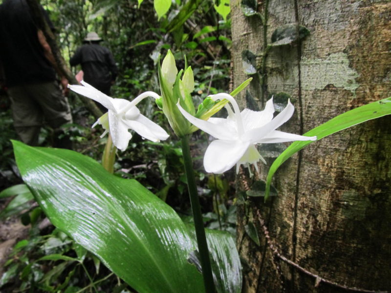
Along the Napo, there are about 1400 acres of rainforest under Tod’s protection. Sadly, there is little animal life left. It was hunted out years ago, once rifles took the place of bows and arrows. (The government has recently outlawed the use and sale of bushmeat.) But there is remarkable diversity in the plant life, including some huge hardwood trees that would surely have been forested had they been on unprotected land.
We hike here, as always, with Kichwa guides, like siblings David and Elodia. Both are distinctively indigenous — short, brown-skinned, dark-eyed, and sharp-featured. Elodia had her first child at 13 or 14; she is now, we figure, about 45. She had ten children (eight survived); her grandson is ten years old her daughter is nine. She is quick to laugh. David looks younger. He is friendly, fit, and engaging, not much over five feet tall. He has rock-star good looks, but he is quiet and serious — until, that is, he makes bird calls or a loud hunter’s whoop at the high ground in the forest.
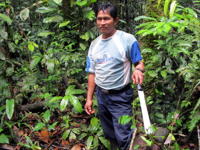
David was trained by his father, a great hunter who was much loved by these trees around us. David moves easily through the forest with remarkable endurance and agility. He says the trees guide him as he hunts or walks or sleeps at night on the forest floor. After his father died, for five years David was unable or unwilling to enter the forest. And then he did. And he asked for guidance. And the tall tree that most closely shared his father’s spirit welcomed him and embraced him. This is what he said.
When we arrived for our hike, it was pouring rain. At the trailhead, we stumbled out of the pick-up truck — ten of us. Elodia gathered palm leaves to use as umbrellas and we headed off down the trail, the mud sucking at our boots. At one point we stopped, as we often did, to talk about where we were and what we saw. Someone asked about the rain.
David said that the trees know their people, the people who belong, just as they know the plants and animals around them. For someone like David, there is, in the motion and the sound of the trees, information about who is here and who is where, and what is new and what is familiar, and this is valuable information for a hunter or for someone walking deep without direction. When there is something or someone new in the forest, the trees notice. And they are at attention. When they are unhappy or uncertain about who is entering, David said, they call for rain.
Later that night, around a fire in the thatched meeting house, I asked my students, “Well — did we learn a lesson or were we taught one?” Both, they decided.
•
The landing at the Tiputini Biodiversity Station was like the landing before, minus Repsol. We had had our second long boat trip of the day, and it was now late afternoon, dusk. We mounted a steep set of rickety wooden stairs to enter an open dining hall.
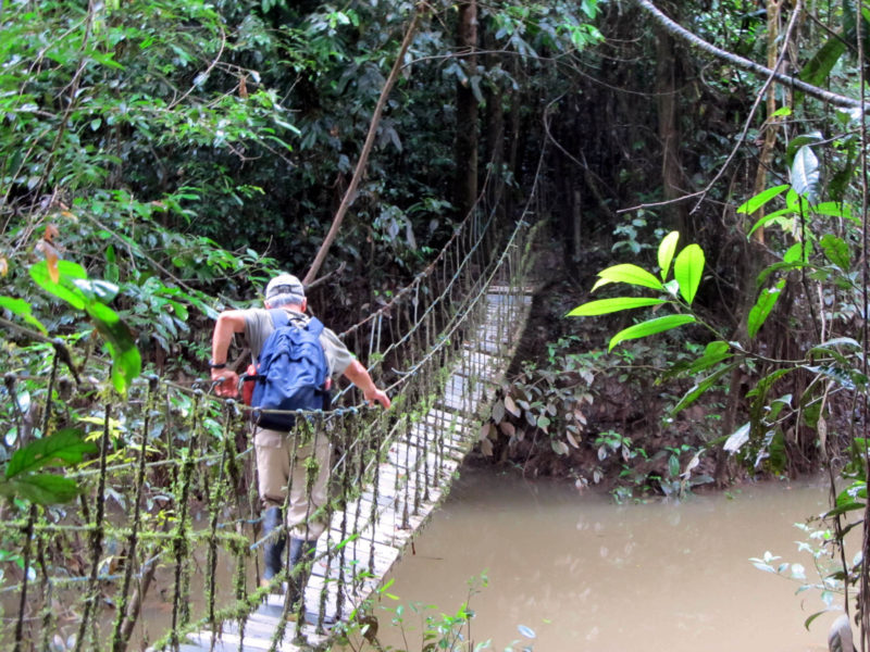
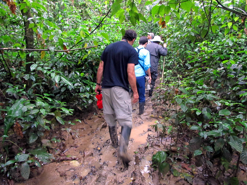
From the dining hall, it was a slippery, muddy hike down a hill and across a wooden bridge, with a moss-covered rope the only aid for balance, and then up a slippery, muddy path to the area where we would stay — small, cedar cabanas built on stilts, along with a larger building, “the Lab,” which housed laboratories for the research scientists (all graduate students), as well as a library and a classroom or lecture hall. The Lab was air-conditioned and included “dry boxes” we could use for our computers, cell phones, or iPads. It was hot, rainy, and humid, and the moisture, we were warned, could make a circuit-board a little wonky. By ten a.m. each day, I was drenched in sweat. When it rained, and it did, I couldn’t get any wetter. We were far, far from cell phone service or internet. We had no hot water and we had electricity for only three hours in the morning, three hours in the evening. Around us the forest was alive with sounds — a chorus of birds, bugs, and animals. Tim had a device that would pick up bat calls and broadcast them in a frequency we could hear, so at dusk, sitting on our porch, we had bats in the chorus as well. I could listen for hours, and I did, but I couldn’t tell a monkey from a bird. Our guides were all locals, men who had grown up hunting and fishing in villages along the Tiputini. They had amazing ears and eyes and were, without exaggeration, “at home” in the rainforest. We had two days with them. I never learned to hear with anything like their precision, depth, or understanding, but I did develop new ways of seeing.
Outside the lab was a giant ceiba tree, maybe 200 feet tall and 15 feet in circumference. The ceiba (or kapok) has soft wood and so, to support its height, it sends out wings or flying buttresses roots, themselves more than six feet tall. There were four of them with this tree, spreading out from the base, gracefully curved like a cupped palm and shaped like large sails. They were covered in soft green moss. The area between the roots harbored a host of other plants, glossy and colorful — fern, hosta, palm, narcissus, and coleus. The ceiba is one of the few trees not covered in vines (perhaps it is too tall) or strangled by the matapalo, a vine that begins with bird droppings high in the canopy, leaving seeds in the tangle of moss and flower where they send down roots, some of which encircle the tree and choke it like a giant snake. The combination of weight at the top and pressure at the bottom brings down most of the trees we see on the forest floor.
The ceiba was a striking presence and impossible to take in at glance. You couldn’t see the top, since it was above the canopy. You couldn’t quite fit the elaborate, broad lower trunk into your line of vision. It couldn’t be framed by a camera — at least not if you wanted the photograph to carry any meaning. A person could fall in love with this tree. I looked for it every day.
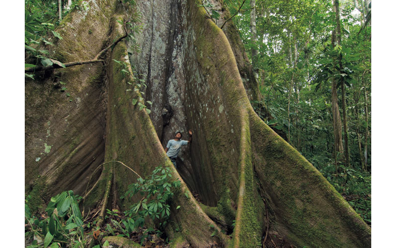
In Kichwa, the language of the villages around our home base on the Napo, the tree is called samona. As the tallest tree, it is considered to be a chief, custodian of the forest. It is inhabited by two spirits, one above and one below. The spirit in the crown looks over the forest and keeps watch. If the spirit is troubled, you can hear it at night, high up in the canopy, making the crying sounds of a child. The spirit at the bottom will sometimes appear as a short man with a round head, which he uses to beat against the buttress roots. The boom resounds through the forest like thunder. The Kichwa, too, will pound on these roots if they should become lost, waiting for a sound in response.
The area at the base of the tree is a perfect place to seek shelter when it rains, but this, we were told, can be dangerous. Later, along the Napo, we asked our Kichwa guide, Pedro, about these spirits. He told the story of a young girl who had become pregnant, the daughter of his cousin’s sister. When pressed, the girl confessed that she had not had sex with anyone — well, actually, only with an odd, round-faced man who kept tempting her in her dreams.
Her child was born deformed. It had a round face, small eyes, large ears, with hair on its arms and back. It looked like a bat. The parents doused the child with gasoline and burned it alive. If the mother suckled that baby, Pedro said, she would bear more and more of these spirit children.
•
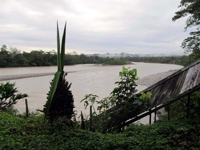
The Tiputini Biodiversity Station was established by the Universidad de San Francisco, in Quito, in 1994, about two decades after the first major highway was built to connect the capital city with the Amazon basin, all part of a conflicted effort by the central government to lay claim to this previously remote territory — to lay claim to its resources, primarily oil; to identify new areas for tourism; and to take stewardship of one of the planet’s last wilderness areas. Before 1975, the major highways from Quito went south to Guayaquil, a major port on the Pacific, and west to the beaches, where a traveler would also find plantations and access to Ecuador’s most famous site, the Galapagos Islands. Now a major highway connects Quito to the East. For over 300 miles it runs up and over the Andes (highest point: the Papallacta pass at over 14,000 feet) and then drops down — the deep green hillsides cut by long, thin cascades of water — to a rich green valley that is home to several rivers feeding the Amazon. This highway was cut at great cost and great effort. It is continually plagued by landslides and wash-outs; it is a highway designed to support the traffic of heavy trucks.
The Yasuní National Park was created in 1979. It includes 3800 square miles of dense rainforest and all that this forest holds. In 1989, Yasuní and the surrounding Huaorani territories were declared a UNESCO “Man and the Biosphere Preserve.” Within its borders live two tribes in voluntary isolation. They have turned their backs on motorbikes and chain saws, social services and public schooling, in order to preserve control over their lives and, they hope, their lands. In the fraught language governments use to manage indigenous peoples, they are called “uncontacted,” an ominous term suggesting what is true, that the next step belongs not to the hunters and gatherers but to some powerful arm of the nation.
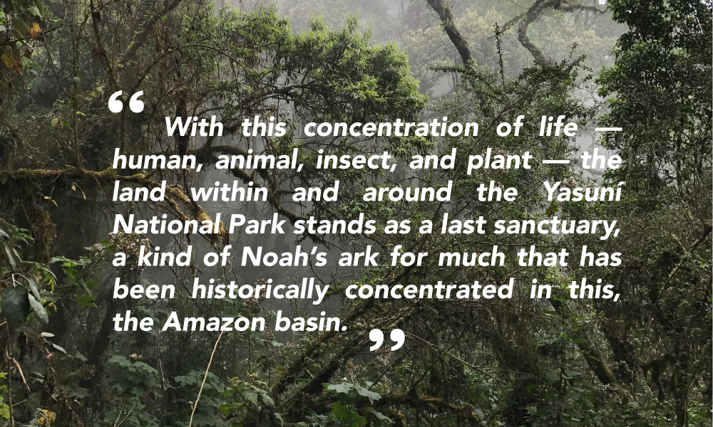
What distinguishes the Yasuní National Park, however, is its incredible biological diversity. It is one of the two richest areas in the world for reptiles and amphibians, and it is home to the highest number of globally threatened vertebrates of any place on earth: toads, turtles, macaws, warblers, spinetails, antshrikes, Amazonian eagles, jaguars, monkeys, wild dogs, giant otters, manatees, tapirs, armadillos, and peccaries. It is the richest area in the world for trees and shrubs, and it is the richest area in the world for bats. While there is not as much global data for insects, it is safe to say that bugs belong on this list as well. According to a recent report, “A single hectare of forest in Yasuní is projected to contain at least 100,000 insect species,” approximately the same number as all insect species found in all of North America.
With this concentration of life — human, animal, insect, and plant — the land within and around the Yasuní National Park stands as a last sanctuary, a kind of Noah’s ark for much that has been historically concentrated in this, the Amazon basin. And the waters are rising. The total area of rainforest in the Amazon basin continues to shrink dramatically as timber is cut for global markets and forest is turned to grazing land to provide beef for markets in Hong Kong and Chicago. The Chinese are investing heavily in oil production and hydroelectric dams; Ecuador’s government has learned to rely on Chinese investments to finance its agenda.
The money is in oil. And the area under Yasuní National Park contains the largest untapped oil field in Ecuador’s piece of the Amazon basin. There is a long and often ugly history of oil exploration on this side of the Andes. Not far from Coca, where we began our journey, is the town named Shell and another, Lago Agrio, named after Sour Lake, Texas, the original home of Texaco. The east-west highways were built to connect these oil fields with the capital, Quito. The land beyond the towns of Shell and Lago Agrio already bears the legacy of the oil boom of the 1970s: rusted pipelines; pollution above and below ground; abandoned drilling sites and oil towns; villages and families disrupted by boom and bust, by new ways of working and living.
But the future is not all below ground. Although threatened by the world’s reliance on fossil fuels, Yasuní’s geography — a moist lowlands within the rain shadow of the Andes — will shelter it from the consequences of global warming, or so it is projected. While in the future much of the rainforest will have more severe cycles of wet and dry and, therefore become something other than rainforest, the areas around the Tiputini and its tributaries are likely to remain wet year round. They will then become a last refuge for those local species responding to climate change — a crowded, vicious, wet, and watery Noah’s ark.
•
We spent Saturday and Sunday at the Tiputini station, and our schedule included two long hikes each day. At our first briefing, Diego Mosquero, the program director, warned us: “The trail will have steep sections. If you slip in the mud, your first instinct will be to reach out and grab something. Don’t. It might be something that doesn’t want to be grabbed.”
I was in a group of four that included Tim and Carly along with Louisa, a biologist from UNAM (the National Autonomous University of Mexico) who was scheduled to lecture in the following week at the University of San Francisco in Quito, but was eager to spend a few days at their research station. Our guide was Mayar Rodriguez. With 20 years’ experience, he was the dean of guides at TBS; he had trained all the others.
Whatever Mayar’s colonial heritage, it was worn away by time and circumstance, although along the Napo he would still most likely be called a colono. He was light-skinned, grey-haired, but short and compact, with indigenous features, including a quick smile that showed missing front teeth. He spoke Spanish and a local language; he had some English, predominately words for plants, bugs, and animals (caterpillar, swallow, kapok tree). He knew the Latin names for plants. Mayar had grown up on the Tiputini and had spent years hunting and fishing to feed his extended family. He had a hunter’s eyes and ears and a local’s familiarity with the voices and the spirits in the rainforest. His pack contained a high-powered telescope and a very fancy digital camera with quite amazing powers to quickly frame, focus, and capture distance shots. He was pleased to be a part of the conservation project at TBS. We joked that he had traded his gun for a camera.
The trails were deep with mud. We wore high rubber boots (also protection from snakes). My old knees struggled with the up and down of the trails, often quite slick; Mayar, noticing this, made me a walking stick. We walked briskly.
On the trail, Mayar would stop suddenly, walk a yard or so away to bring into view something hidden. He spotted a tiny bright red mushroom, no bigger than a plastic pinhead on a two- or three-inch white stalk. He dug it carefully from a rotting trunk and placed it in his hand. (Later, he would return it to its place in the forest.) This was a cordycep, the “zombie fungus” whose spores would spread to insects, where they would root and suck the life out of the unsuspecting bug. We saw one growing out of a now-dead ant; one growing out of a dead grasshopper; one growing out of a three-inch larva.
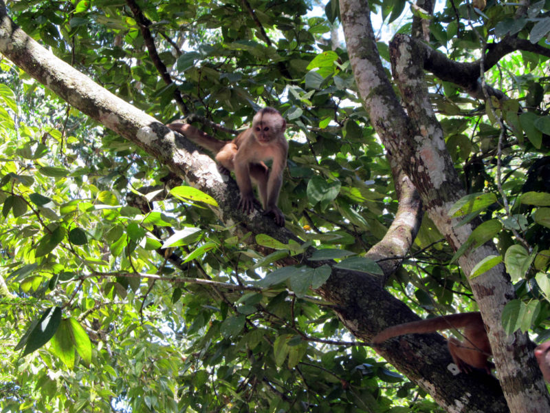
Mayar had the same eye for birds and monkeys. He’d stop, spot something in a tree (sometimes color, sometimes sound, sometimes movement), we’d gather as silently as we could, he’d point, and it would take the rest of us several minutes to locate the toucan, the wooly monkey, or the barbitos. While we were searching the canopy, he’d snap a photo to show us what (often) we had missed. Or, with the photo and with his help, we’d start again and end with a sighting.
What did we see? We saw seven of the 11 species of monkeys in the area: pocket monkeys (pigmy marmosets), tamarin monkeys, wooly monkeys (churungos, including one who fell about two stories from the canopy), howler monkeys, spider monkeys, an owl monkey, a dusky titi. At one point, we came upon pocket monkeys sucking sap from holes they made in an old, tall ceiba. They were driven away by larger, yellow-backed tamarin monkeys — lovely animals to see, although we were initially taken aback by their aggression. One tough-minded pocket monkey, a little guy, stayed behind to sneak back when the tamarins weren’t watching. And there was a large wooly monkey above, looking down and observing the action. It was quite amazing. I had monkeys running and jumping around me the way I have squirrels on the patio of my Western Pennsylvania home.
I was the first to spot a two-toed sloth. He was slow and noisy as he made his way from branch to branch to the left of the trail. The Spanish word for sloth is perezoso (the lazy one); this lazy one was moving deliberately from tree to ground to have his morning dump. (Sloths only poop on the ground — and not every day.) He saw us and stopped and stared. We had clearly upset his schedule. And he started slowly, very slowly making his way back again up the tree.
We spent an afternoon at 150 feet, high up in a platform on a rise (in a ceiba tree). The platform gave us a view across the rainforest canopy. We saw birds and monkeys, but what I most remember are the branches of that tree. There at 150 feet each branch wore an elaborate, crowded garden, like a sleeve filled with ferns, ivy, coleus, creepers, and flowers, some waxy leafed, some delicate — and epiphytes, like the zebra bromeliad, which we saw in the dozens, all large, brightly colored striped urns, turned up and waiting to catch the rain.
From the ground, too, or from a slow float on the river, we saw birds: ivory-billed toucans, jacamars, cuckoos, river swallows, oropendula, parrots, barbitos (like gold finches, but larger), ani, flycatchers (yellow and black), vultures, a jay (as blue as an indigo bunting), a kingfisher, hoatzin (“stinkbirds”), hummingbirds, and curassows (turkey-like water birds with bright red markings). I can list them; I can number them, like acquisitions; I can check them off in my bird book. There is not much more I can do. I would often try to snap pictures of the birds and monkeys, even the sloth, but I was too slow or too unsteady; all I would get is a blur of color in a blur of green.
Sunday morning we went by boat and trail to a lake, where we used a canoe to explore (a traditional canoe, cut from a single log). I had seen some animals across the lake when we arrived and assumed they were capybara (dog-sized water rats). As Mayar paddled us out, we faced a panicky school of fish, swirling and jumping, and then we saw giant river otter raise his head out of the water in a display of territorial defiance; he was long-necked, gorgeous, his fur spotted light brown with yellow dripping water. He looked at first like a big snake. He showed his teeth and growled with a loud, menacing voice.
We later learned that this is a rare and endangered species. We paddled some more. The otter who had confronted us had gone to get his buddies. Strength in numbers. We had another display; this time three otters lined up in front of us, their necks raised high out of the water (these are big animals, as long as six feet), and they showed their teeth and they roared their roars. And then they were gone. It never occurred to me to grab a camera.
As we prepared to leave Yasuní, I told Mayar that I would like to buy some of the photos he had taken while we were hiking. I figured this would be simple. I’d leave some money; he could send digital images to my email address. He said it wasn’t allowed. I spoke with Louisa, whose Spanish is better than mine and who might come across less like a greedy American consumer. She spoke with Diego, making a case not only on behalf of Mayar’s art but on behalf of the research station. Diego said, “We just don’t do that here.”
“What was that all about?” Carly asked. “I don’t know,” I said. “Maybe they didn’t want to upset the balance of things.” Perhaps the reasons were local and deep — a sense that one must honor the spirit of the rainforest, not sell it. But, then again, perhaps TBS wanted control over these images. Perhaps Diego didn’t want Mayar to be freelancing, to be making extra money on the side, creating competition among the guides. Who knows about balance in a place like this?
•
My wife and I slept by the river Napo in a cabana with a thatched roof. We listened to the river at night and to the sounds of the forest around us. There was a small possum in the thatch by the dining hall, bats in the rafters of the hall, and a chicken who visits the classroom while I am teaching, all of whom I’d seen. And there were two tree frogs who lived in the thatch above our room. I didn’t see them, although I’d tried. At first we thought they were in the room and I went hunting for them in the corners and under the beds.
They peeped back and forth to each other from dusk until around ten p.m., when we fell asleep. Perhaps they went on. They were in the thatch, talking back and forth. We heard one clear peep, a single burst that said something, and it was answered by another, a peep saying something back. This went on and on at regular intervals.
The tree frogs sound like satellites in the night sky — the ones you’d hear in ’70s cartoons or space movies. Or they sound like the spring peepers around my patio in Pittsburgh. But they are not satellites, and they are not spring peepers around my Pittsburgh patio. I don’t know how to see them, and I don’t quite know how to name them. We slept with them easily; it’s comforting, here along the Napo, over the Andes from Quito, near the last outpost before the thick forest reaching into Peru, then Brazil.
I asked Tod about these tree frogs and what they were called. He wasn’t sure. He thought maybe piri-piri. But then he said, “No, that’s not it.” •
Images courtesy of David Bartholomae.
Feature image courtesy of Theodore Moore on Unsplash